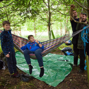
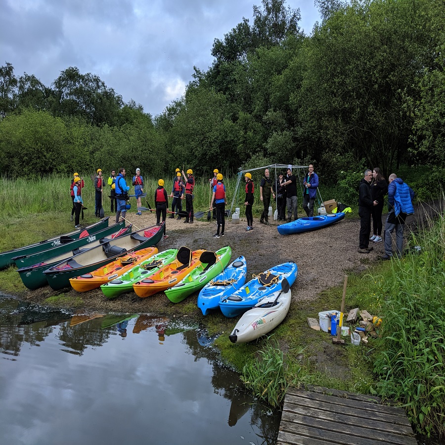
This event is for both seasoned runners/walkers and also families which wish to join us for a shorter, leisurely walk around the Moors.
Please select your choice of walk/run below.
8-mile Family Walk
19-mile Walk/Run
25-mile Walk/Run
PLEASE NOTE:
Due to numbers of both applications and volunteers for bases, we have regrettably decided to cancel the 25-mile walk/run and move people over to the shorter 19 mile event and offer a refund if this is not a possibility.
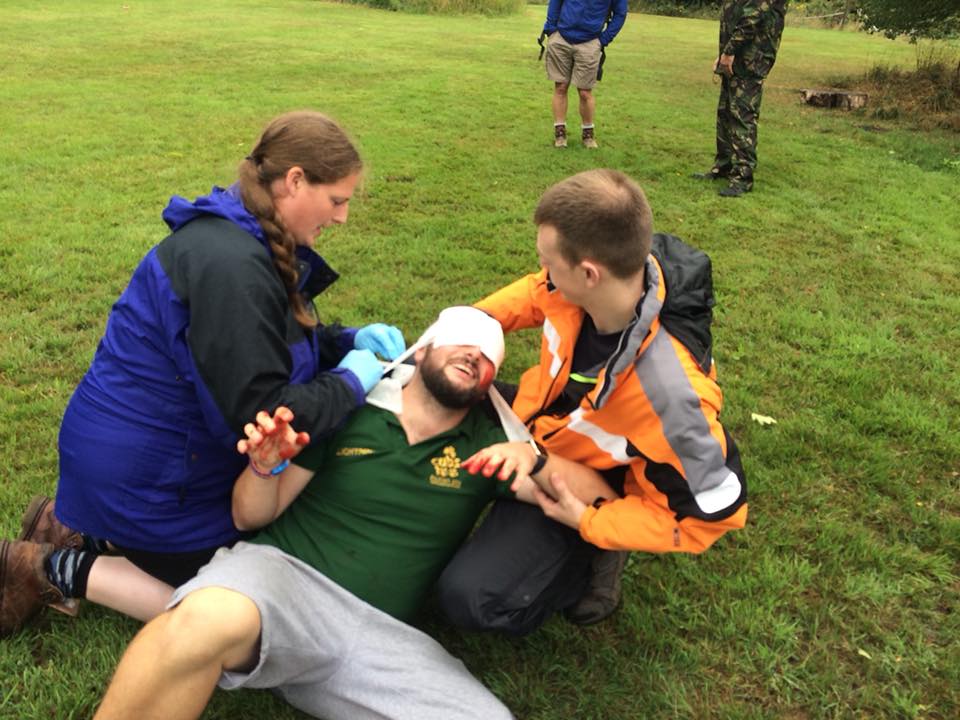
Safety is our top concern for all events and we hope our entrants will appreciate and support this decision.
The two longer ones are open to all walkers/runners aged over 14 on the day of the event. Under 18’s must be accompanied by an adult.
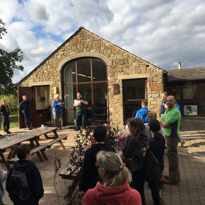
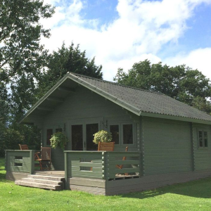
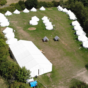
The route takes you through the spectacular West Pennine Moors and starts and finishes at Bibbys Farm.
19-mile goes through White Coppice, Brinscall, Great Hill and Rivington and the 25-mile also includes Belmont and Winter Hill
The 8-mile family walk visits Healey Nab, the Anglezarke reservoirs and Rivington Village.
Start times are staged:
09:30 19-mile Walkers
10:00 19-mile Runners
10:30 8-mile Family Walkers
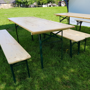
The fee includes refreshments at most checkpoints and a hot, 2 course meal at the finish. Badge & certificate to all who complete the walk.
Bibbys Farm has a strict NO DOGS policy, however, provision has been made at the car park for dogs to be left for a short time whilst walkers/runners register or check back in and have their meal. Please make us aware on your application if intending to bring a dog.
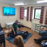
Please bring with you: MUG for Drinks, compass, torch with spare bulb & batteries, whistle, survival bag, first aid kit, hiking trousers (Not jeans) waterproof jacket & trousers, suitable footwear and emergency food rations for the day.
BIBBYS WEST PENNINE MOORS CHALLENGE – 25 AND 18 MILE ROUTE DESCRIPTION
Key: TL – turn left; TR – turn right; BL – bear left; BR – bear right; SA – straight ahead; L – left; R – right; PFS – public footpath sign; FB – footbridge(s); St – stile; LSt – ladder stile; SGP – stone gate post / pillar(s); Rd – road; KG – kissing gate; ml – mile; CP – check point; GR – grid reference
Start to Brinscall (CHECK POINT 1) GR627213
TR out of registration past bunkhouse downhill to motorway (mway). Cross mway bridge. TR. Follow path keeping mway fence on R over St. TL downhill to canal. TR then over St behind buildings. Follow through then TR and over mway. TL at PFS over St. Over second St at drain. path through field (fence on R). At fork in path (small pond on R) BL Continue over stream (abandoned caravan on L) emerging onto industrial estate access Rd. Ignore St and instead TR along tarmac past Private Rd sign. At bend in Rd TL through metal KG. With reservoir on L, TR under metal arch and up steps. Reservoir on L. Through gate and over St. Second St continuing uphill to top L of field. TL through gap in gorse hedge. Immediately TR over St into trees of Nab Wood. Follow path up. Ignore KG and instead TL along narrow path dropping down, IGNOR PATH TO L BUT TR through gate going uphill to main track, ignoring bike trails on either side (take care of mountain bikers). TL at paths junction, and continue through KG at metal gate at edge of wood. Downhill on path with fence on R. Through KG at metal gate joining vehicle track. Continue round L of Higher Healey Cottage. Follow access track to Rd. TR along road taking first L at PFS over St. Cross field diagonally to St with stream on R. Cross field with reservoir on L using FB, boardwalk and second FB. TR and enter village over bridge on Coppice Lane. TL over FB by ford. Follow rising concrete drive. At bend ignore path on L and stay on drive to Total’s Farm (past letter box on L confusingly marked as Higher White Coppice Farm). BL in front of green painted stone cottage. SA to R of ruined barn to pair of St at end of trees. Take St on R of pair keeping mossy wall on L Over St at field entrance. SA over second St into continuation of path. At end BR over St with wooden pallet fence on L. At end of fence under oak tree, cross over St into field. SA to rear of white building ignoring path on L. Through gate and through Old Withnell’s Barn and Farmhouse conversions. Down track and through KG on bend. SA across field – beware of hole in middle of FB. Over St then L through KG over stream. BR across field to left of beech hedge. Through KG onto dismantled railway. With stone wall on R continue until railway becomes private property (sheds / yard). Don’t go through metal gate but TR through KG onto cobbled lane. TL past “Wildwood Days” then SA down lane through KG at cattle grid. SA past railway bridge on L, then houses along Rd to CHECK POINT 1 at Brinscall Swimming Pool car park.GR627213
Brinscall to Roddlesworth Lane (CHECK POINT 2) GR 649218
Head to L of play area through sculpted gate onto Rd. TR over bridge then TR again onto Well Lane. Follow Rd uphill over speed bumps ignoring paths on R and L. AFTER APPOX ¼ ML At slight widening of Rd BL uphill (ignore path on the R) After a few metres as trees begin to thin out and moorland appears, TL over St at old metal gate. Follow rough track through gorse to marker post. TR here to enter Access Land with stone wall on R. Path becomes indistinct and wall drops away and reappears but continue uphill towards ruined barn. Near top of field cross wall into field to reach St. Cross St then TL over second St. SA past two SGP on R then stone wall leaving barn behind. Darwen Jubilee Tower appears in view. SA to marker post. Ignore path on R and instead BL away from wall. Cross little used vehicle track and go SA on poorly defined path to gate visible at next stone wall. SA through KG). Drop downhill to fence and marker post using stepping stones. Leave Access Land here and SA keeping stone wall on R to reach marker post on track. TL downhill along track. Over St then TR to follow fence as it BR downhill to FB. Cross water then uphill alongside fence before going down again to St at gate. Down to main Rd. Cross with care (busy 50mph Rd with limited view for drivers), then TL on pavement to
CHECK POINT 2 at Rd junction between main road and Roddlesworth Lane GR 649218
Roddlesworth Lane to Calf Hey Bridge CHECK POINT 3 GR658201
Follow Rd past first buildings to PFS. TL through metal gate, then through gate behind barn next to vehicle gate. SA downhill to KG at metal gate. Enter trees. SA through very small car park to dam. Walk along bottom of Roddlesworth reservoir embankment past raised brick man hole covers, climbing up far side with overflow on L. Go up steps and cross overflow then R through KG. Follow path alongside water until it emerges on main track. This track is a permissive bridleway – beware of horses. TR over bridge by 2 bar fencing, ignore path to R but SA on meandering track through Tockholes plantations for significant distance. As reservoir on R ends and fence on L (with gap for path access) begins after short rise maintain previous direction on track. Pass through newly planted trees to path junction. Again maintain direction downhill past SGP on L to metal gate. Do not cross river using bridge but instead BL following path with river on R. At top of climb, BR to leave track using narrow path (Do Not Pollute Water sign on tree). Follow path (very muddy) by stream using set of steps to finally reach simple concrete bridge. Cross river and follow path uphill to emerge at CHECK POINT 3 on main Rd – take care as not much space at roadside.GR658201
Calf Hey Bridge to Hordern Stoops CHECK POINT 4 GR 655158
Cross main Rd with care (busy 50mph Rd with limited view for drivers). TL past 40mph corner warning sign. TR at PFS. Over St. Follow path with fence on L. Cross FB carefully (in bad repair) and continue SA. Stone wall comes in from R. Head towards only copse of trees visible (Ruins of Pimms), ignoring new KG on L. Cross streams leaving fence behind, then cross wall and continue up to trees using brief boardwalk. From ruins at Pimms follow narrow path SA to join main path. TR up to summit of Great Hill. Enjoy views and benefits of sheltered seats before TL to head down marked paved path towards Winter Hill. Over St at base of hill then easy walking along paved path and stone bridges through Redmond’s Edge then Spitler’s Edge. At end of paving path becomes gravel with intermittent stone slabs. Continue SA eventually dropping downhill to St. Cross and SA to CHECK POINT 4 at Horden Stoops car park.GR 655158 (CUT OFF TIME WALK 1.40PM RUN 2.30PM)
THE 18 ML ROUTE LEAVES THE 25 ML ROUTE AT CHECK POINT 4 HORDEN STOOPS (GR 655 154)
From the CP car park, TR and follow Rd verge. When opposite a stoned access junction, cross the Rd with care and follow track to KG by metal gate SA on stoned track (Belmont Rd) for approximately 1¼ ml, ignoring paths to the L and R, eventually reaching, the Pigeon Tower, TL before building and BR over field TR when another path is reached then KG and TR on wide track and continue to CHECK POINT 9 in Car Park GR638148
THE 18 ML ROUTE REJOINTS THE 25 ML ROUTE AT CHECK POINT 9
Hordern Stoops to San Marino restaurant CHECK POINT 5 GR679153
TL slightly downhill along road past 30mph corner warning sign. Take care and do not linger as national speed limit applies and no pavement. At PFS on L over St. BR to follow path gradually moving away from Rd. At stone wall leave Access Land and pass through KG and SA dropping downhill towards outskirts of Belmont. Cross next wall using stone steps in wall and continue with fence on L to KG at metal gate by two red litter bins. Ignore path on R and instead go SA on track into housing and SA to main road. TR downhill through village passing Black Dog on R cross main Rd using traffic island. TR downhill cross Egerton Rd junction with care. Follow main Rd as it climbs up continuing on pavement to CHECK POINT 5 at Lotties cafe and San Marino restaurant car park.GR679153
San Marino restaurant to Winter Hill CHECK POINT 6 GR660143
TL out of CP to continue as before for a few metres beyond 50mph speed signs. Cross road near bright yellow speed camera to go through KG set back in stone wall (marked with green metal PFS for Winter Hill). Keep to R of harvested pine plantation and head uphill with stream on L to KG at track. Returning into Access Land BR uphill towards partially visible Winter Hill TV mast. Upwards and slightly L cross a small stream near a stone wall. All masts on summit now visible. Continue on obvious path. Just before summit pass through KG and two SGP to reach tarmac service Rd. TL on Rd towards largest mast. As you enter and pass through mast site note red memorial plaque to George Henderson (near fence at L side of Rd) then black memorial plaque to Winter Hill air disaster (on brick building on R). SA to leave mast site at old cattle grid reaching PFS and CHECK POINT 6 on L.GR660143 CUT OFF TIME WALK AND RUN 3.30PM.
Winter Hill to Walker Fold CHECK POINT 7(GR 676 123)
Leave CHECK POINT 6 at PFS and follow stone slabbed path over moors, keeping fence on L (some sections missing so take care). At end of slabs through KG. TR at PFS and follow track for approximately ¾ ml. Just before green sign “I get cold without my mum” TR over St and follow path through Roscoe’s Tennent Clough keeping stream on left to KG and minor road. Cross road and SA on private road, signed “Walker Fold”. When road bends DO NOT GO INTO THE FARM COMPLEX but TL at PFS over St and follow path downhill and then parallel with the stream. Cross stream on FB; SA uphill to KG then on path between fences to building. Before building TR at FPS over St and follow path over fields to KG, then through area of tree planting to KGs, then into woodland [path marked with red dots through wood] to a St into Walker Fold Wood. Descend into valley using steps – take care, BL at junction of paths, TR over iron FB to cross stream. TL at St and follow footpath and wooden boardwalk which leads to KG at the Rd Do not cross Rd but TR and continue to CHECK POINT 7 at Walker Fold (GR 676 123)
Walker Fold to Pike Cottage CHECK POINT 8 (GR 648 131)
Leave Rd though metal KG passing “welcome to Smithills Estate” sign. SA on wide track for approximately 0.4 mile to KG; SA for a few yards then BL at PFS and SA when footpaths cross. Continue on rough track/path uphill, at corner of stone wall BL with wall on R and make for post on the skyline. TR and follow track downhill through KG. TL at PFS and follow track to KG and road, TL and immediately TR through KG and follow path over moors. At metal fencing TL downhill, at corner of stone wall BL and continue to KG and minor road [Wilderswood] TL on road and follow to CHECK POINT 8 at Pike Cottage (GR 648 131)
Pike Cottage to Pigeon Tower car park
Continue on road/track, ignoring paths to the R (uphill to tower) and to the L but continue SA to where the tracks divert at the Pigeon Tower (GR 640 143). After building TL through KG/gap in fence and BR over field, TR when another path is reached then through KG and TR on wide track, continue to CHECK POINT 9 in the car park GR 638 148
THE 18 MILE ROUTE REJOINS THE 25 MILE ROUTE HERE
Pigeon Tower Carpark to Horrobin Cottage CHECK POINT 10 (GR 621 142)
TR along minor road then TL at KG and follow track when track bends SA following line of trees to rejoin track BL to KG and then building [Higher Rivington Barn]. Cross car park, SA (through barrier) along driveway. When driveway splits, BR to Rd. Cross – very busy so take CARE, and go through gap in hedge, TL and follow path, TR over FB then TR and follow path through woods to join car park area behind Rivington School. TR past the school stone wall on the R to Rd Cross with care and TL, then keeping on the pavement and follow Rd between two reservoirs to the junction with The Street and CHECK POINT 10 at Horrobin Cottage (GR 621 142)
Horrobin Cottage to Bibbys farm FINISH
Continue along The Street ignoring the track to Cunliffe Farm, pass the giant filter needles on the R and cross over the river. At start of trees TL at PFS through KG and over field to farm and continue through farm yard, passing farmhouse dated 1757. Follow farm assess track to Rd, TL over bridge then TR over St and follow track to next gate, TL keeping hedge on R to St, TR, keeping mway hedge on L. Continue SA at next gate, then TR and follow wooden fence to St, TL over St then. TR on tarmac Rd to for approx. 50 metres. At bridleway sign SA keeping to R of building. Use FB to cross steam. Then TL and follow path over several Sts through valley to meet Rd (Charnock Back Lane). TR and continue uphill to Bibbys Farm and refreshments.
CONGRATUALIONS
Bookings
Bookings are closed for this event.